AROUND THE WORLD
Anti-submarine Indicator Loop stations in the United States
North Scituate - Boston, MA
 |
| Drawing by Gerry Butler |
Loop receiving stations, as they
were known, were operated by the United States Navy. They were used in WW2
as part of the Harbor Defenses and consisted of indicator loops, controlled
minefields, boom nets, fixed sonar (the Herald: harbor echo ranging and
listening devices).
This page deals specifically with the indicator loop antisubmarine defences
between Fourth Cliff (North Scituate) and Provincetown on the northern tip of
Cape Code, Massachusetts, USA.
 |
If you worked there or have any feedback please email me: Dr Richard Walding Research Fellow - School of Science Griffith University Brisbane, Australia Email: waldingr49@gmail.com |

LINKS TO RELATED PAGES:

Peaked Hill Bar was one of the original nine stations which were erected on Cape Cod in 1872. It is located 2½ miles northeast of Provincetown on the northern tip of Cape Cod. "A more bleak or dangerous stretch of coast can hardly be found in the United States than at this station. The coast near the station rightly bears the name 'ocean graveyard'. Sunken rips stretch far Out under the sea at this place, ever ready to grasp the keels of the ships that sail down upon them, and many appalling disasters have taken place here. There are two lines of bars that lie submerged off the shore ... these bars are ever shifting."
 |
 |
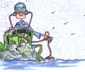
| 1. The Pequot crew aboard the DUKW heading for shore to collect the indicator loop tail cable for joining aboard the Pequot. | 2. The heavy, armoured tail cable is being dragged from the Peaked Hill Bar beach by the crew. |
 |
 |
| 3. The indicator loop tail cable being dragged out to sea. It has 4 cores of 7 strand copper wire insulated with a rubber sheath and armoured with 20 galvanised steel wires, braided with hemp yarns and compounded with a tar preservative. | 4. In the name DUKW, the D indicates a vehicle designed in 1942, the U meant "utility (amphibious)", the K indicated all-wheel drive and the W indicated two powered rear axles. General Motors devised the acronym. |
 |
 |
| 5. The DUKW was powered by a GMC Straight-6 engine of 270 in3 (4.416 L). It weighed 7.5 tons and operated at 6.4 mph (10 km/h) on water and 50-55 mph (80 km/h) on land. The propeller can clearly be seen. | 6. The indicator loop 'tail' cable has been tied to the DUKW by the Pequot crew and will be dragged out to the Pequot ready for joining to the loop cables and sealed in a waterproof junction box. The shore-end of the tail cable is connected to the instruments in the shore "loop receiving station" higher up the beach. |
 |
 |
| 7. The DUKW's tire pressure could be varied from inside the cab. On beach sand the pressure was reduced. | 8. The building in the background may be the "Loop Receiving Station" (LRS) where the indicator loop is monitored. |
The interpretation of loop signatures and examples can be found at: Reading Loop Signatures.
SOME USN INDICATOR LOOP LINKS